
Browse Items (10 total)
- Collection: Mapping New Silk Roads
Sort by:
Geocoding news: Silk Road Economic Belt from LexisNexis
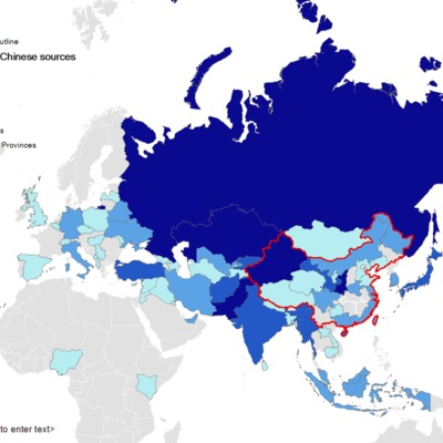
I mapped all the news search result of Silk Road Economic Belt from LexisNexis academic news database, according to the geography analyzed by SmartIndexing of the site. The two maps are those of Chinese state-owned news agencies and other…
Geocoding news contents: Xinhua.net news on the Silk Road Economic Belt and 21st Century Maritime Silk Road
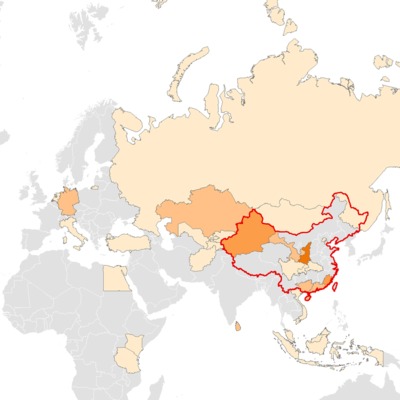
I geocoded the Xinhua.net news archives of the Silk Road Economic Belt and 21st Century Maritime Silk Road feature page (http://www.xinhuanet.com/english/special/silkroad/, available in Chinese, English and Russian), and mapped them in ArcGIS. Note…
Opening the black box of China
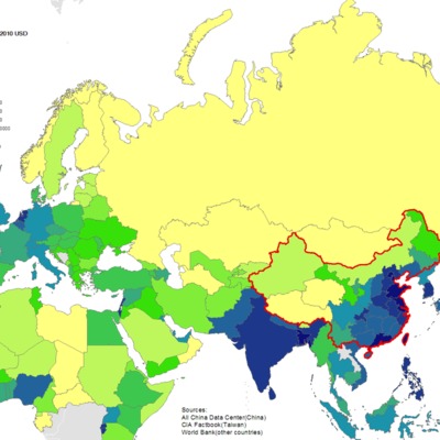
I visualized the series of (population density, GDP, GDP per capita, FDI) on a map that juxtaposes provinces of China and other countries in the Silk Road region, so they are in a sense more comparable in scale. Data sources includes World Bank …
Silk Road countries and their trade partners
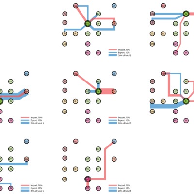
Silk Road countries and their trade partners. Data source: CIA Factbook
the Iron Silk Road

Railroads from China to Europe
Oil and gas pipelines in Central Asia
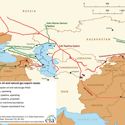
Oil and gas pipelines in Central Asia. Note: The Kazakhstan-Chinese pipeline (green) from Atyrau (north of Aktau) to China is finished by now
A (very sketchy) map of the Silk Road initiatives

A (very sketchy) map of a series of international new Silk Road initiatives since 1998.
World Heritage Site: The Silk Roads Initial Section of the Silk Roads, the Routes Network of Tian-shan Corridor

Site map of the World Cultural Heritage (WHC attachment to the site page) overlaid with the historical Silk Road map from (item 959) report;
The Belt and the Road
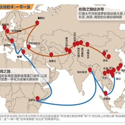
A internet user drawn map of the Silk Road Economic Belt and 21st Century Maritime Silk Road (中国版战略载体:一带一路)
The Silk Road in the middle ages

One of the many illustrations of the historical Silk Road(s). Original photographer unknown.